Delivering advanced aerial data solutions powered by cutting-edge drone technology and experienced emergency response professionals.
Whether you’re managing risk, responding to emergencies, or mapping the unknown, our fleet is ready to support your mission — anywhere, anytime.
Our capabilities include:
Real-time tethered surveillance with Fotokite
Our Fotokite Sigma system provides safe, persistent aerial overwatch without reliance on GPS or piloting. Tethered to a vehicle or command post, it delivers instant situational awareness for public safety, event security, fireground management, and incident command — with 24/7 operational capability, even in GPS-denied or crowded airspace.
Our Fotokite Sigma system provides safe, persistent aerial overwatch without reliance on GPS or piloting. Tethered to a vehicle or command post, it delivers instant situational awareness for public safety, event security, fireground management, and incident command — with 24/7 operational capability, even in GPS-denied or crowded airspace.
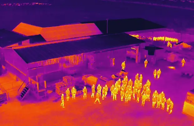
Detect heat sources in real time — ideal for search and rescue, fireground overwatch, night operations, wildlife surveys, and infrastructure inspections.
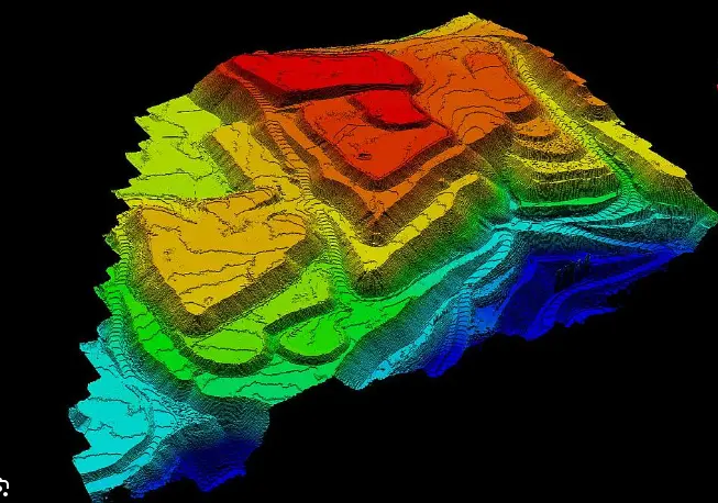
Capture accurate 3D terrain models and vegetation profiles, even through dense canopy. Perfect for disaster planning, engineering surveys, and line-of-sight clearance assessments.
Capture accurate 3D terrain models and vegetation profiles, even through dense canopy. Perfect for disaster planning, engineering surveys, and line-of-sight clearance assessments.
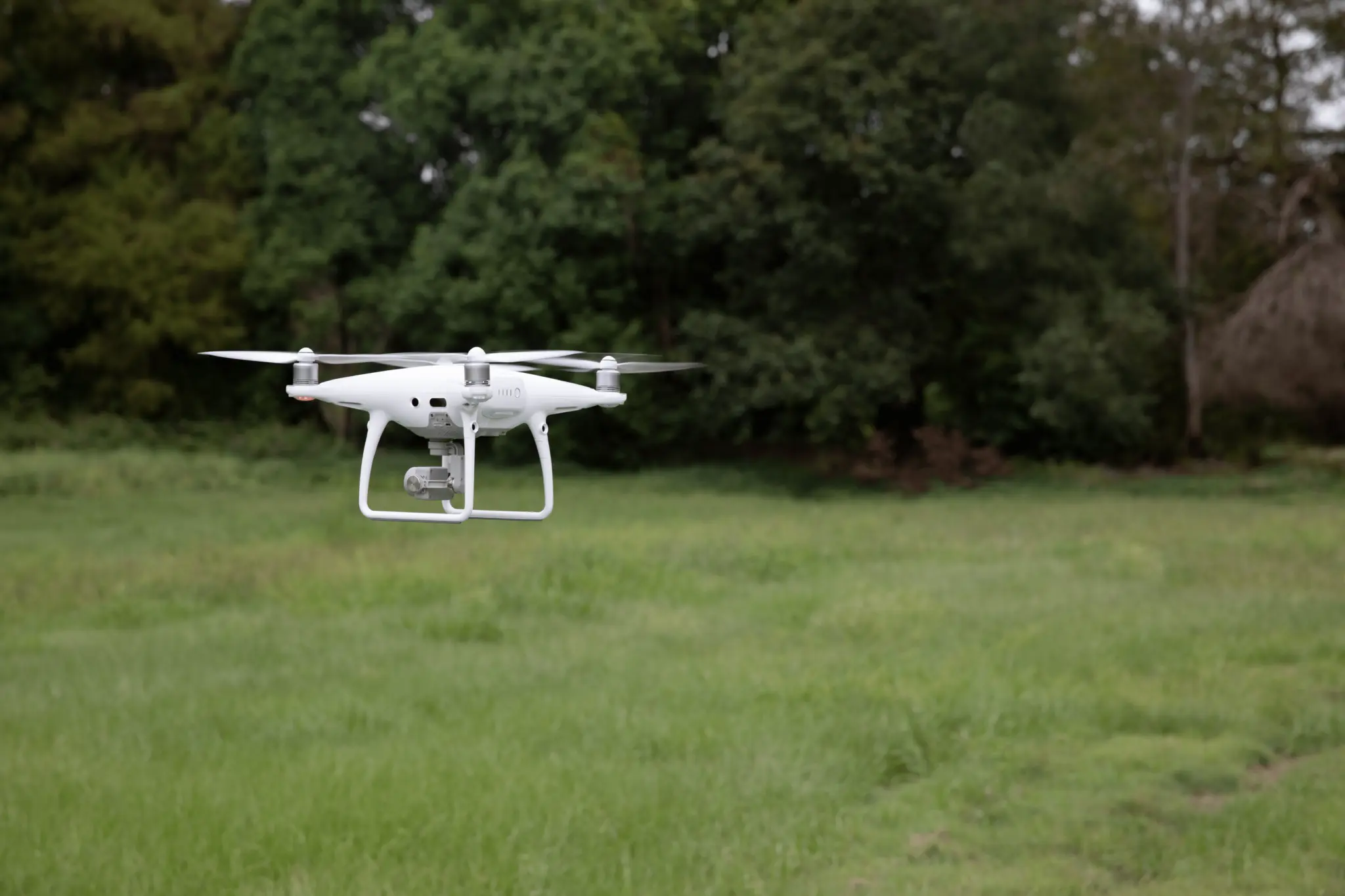
Capture precise, high-resolution aerial imagery for detailed 2D maps and 3D models. Our drone-based mapping delivers accurate geospatial data for land development, construction, environmental monitoring, and emergency planning—faster and more cost-effectively than traditional methods.
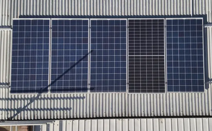
Safely inspect critical infrastructure, such as power lines, towers, buildings, roofs, and pipelines – without disrupting operations. Our drones provide high-definition imagery, reducing risk, improving efficiency, and enabling proactive maintenance decisions.
Safely inspect critical infrastructure—such as power lines, towers, buildings, roofs, and pipelines, without disrupting operations. Our drones provide high-definition imagery, reducing risk, improving efficiency, and enabling proactive maintenance decisions.
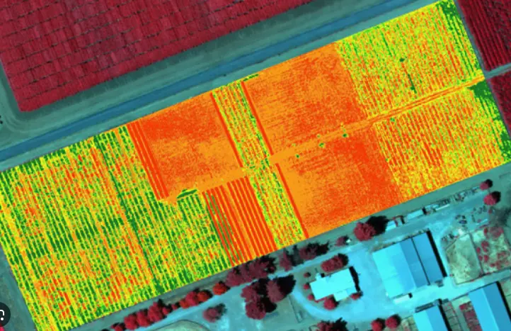
Multispectral drones capture data across multiple light spectrums (including visible and near-infrared), enabling analysis of vegetation health, water stress, crop performance, and environmental conditions. Commonly used in agriculture, land management, and environmental monitoring, they support data-driven decision-making for improved productivity and sustainability.
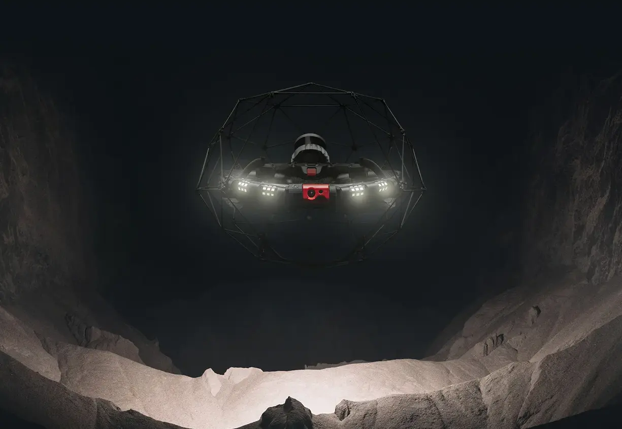
Advanced confined space inspection capabilities using the Flyability Elios 3 — a collision-tolerant drone purpose-built for complex, GPS-denied environments. Our solution eliminates the need for manual entry into hazardous areas such as tanks, silos, tunnels, and ducts, dramatically improving safety and reducing downtime. Equipped with LiDAR, 4K visual, and thermal imaging, we capture detailed, actionable data in a single flight, enabling faster decision-making and cost-effective asset management.
Advanced confined space inspection capabilities using the Flyability Elios 3 — a collision-tolerant drone purpose-built for complex, GPS-denied environments. Our solution eliminates the need for manual entry into hazardous areas such as tanks, silos, tunnels, and ducts, dramatically improving safety and reducing downtime. Equipped with LiDAR, 4K visual, and thermal imaging, we capture detailed, actionable data in a single flight, enabling faster decision-making and cost-effective asset management.
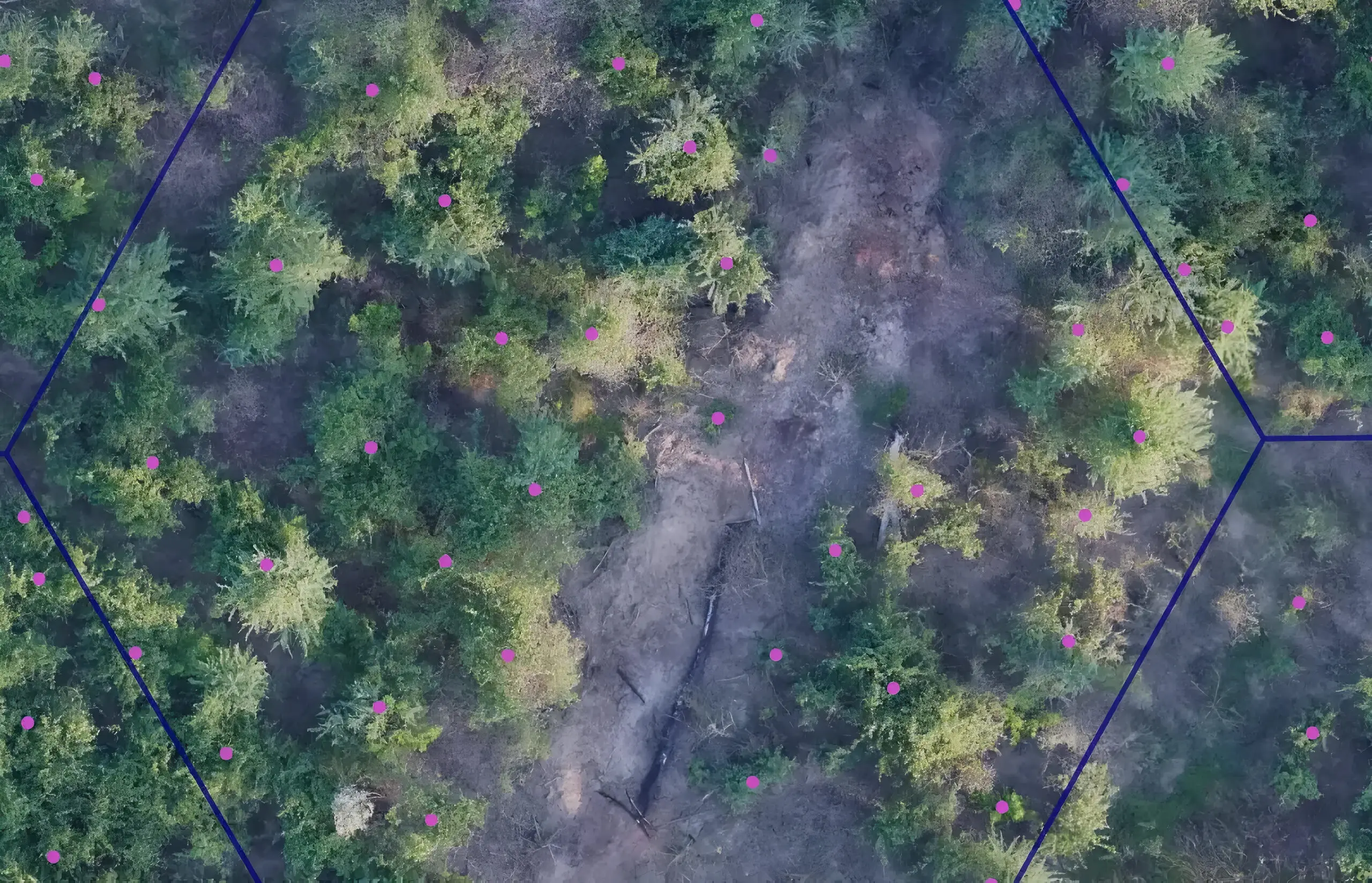
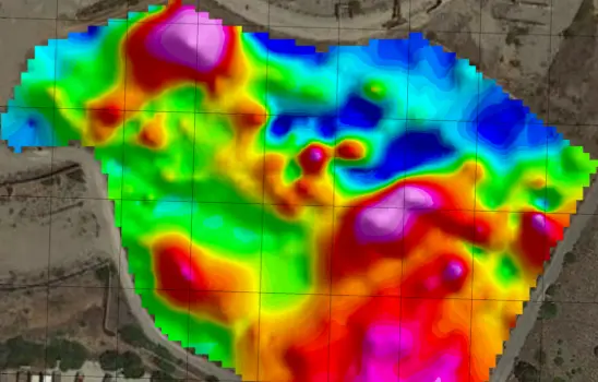
Conduct non-invasive subsurface detection for buried objects, utilities, or unexploded ordnance (UXO). Valuable for environmental studies, defence clearance, and mining.
Drones equipped with ground penetrating radar can detect and map objects, voids, and anomalies beneath the surface without excavation. This capability is ideal for infrastructure inspections, utility detection, archaeology, and geotechnical surveys — improving safety and efficiency in subsurface exploration.
Drones equipped with ground penetrating radar can detect and map objects, voids, and anomalies beneath the surface without excavation. This capability is ideal for infrastructure inspections, utility detection, archaeology, and geotechnical surveys — improving safety and efficiency in subsurface exploration.
Radiation-detection drones use onboard sensors to identify and map sources of ionising radiation from a safe distance. Commonly used in emergency response, mining, decommissioning, and nuclear facility monitoring, they allow rapid hazard assessment in contaminated or high-risk environments without endangering personnel.
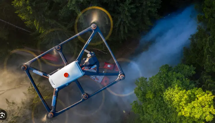
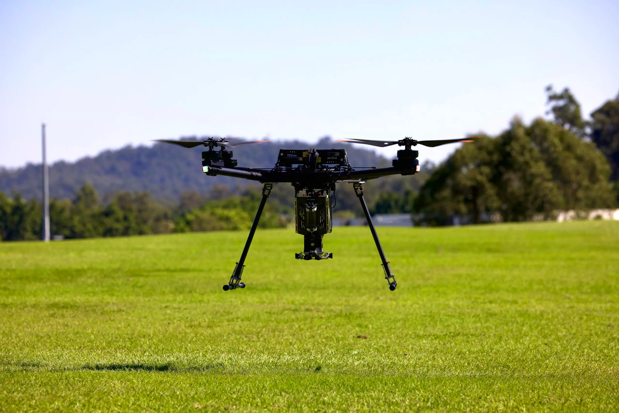
Our Alta X combined with the IGNIS aerial ignition payload is a complete drone-based firefighting system. We have found this combination to be ideal for maximum efficiency during backburn and prescribed fire operations.
Our Alta X combined with the IGNIS aerial ignition payload is a complete drone-based firefighting system. We have found this combination to be ideal for maximum efficiency during backburn and prescribed fire operations.